Because Mairin Glenn and I agreed to be present at the American Education Research Conference (AERA) in Denver on April 23-27, she and Red and Bill and I decided to share accommodation. After our presentations were over, Bill and I took an excursion to the Grand Canyon, one of the Seven Natural Wonders of the World (along with Aurora Borealis, Victoria Falls, Mount Everest, Paricutin, -cinder volcano in Mexico, Great Barrier Reef, Harbour of Rio de la Janeiro). It was a busy week!
Wednesday, April 23
After the AC Flight from Toronto to Denver leaving at 8:00 and arriving at noon, we took the train into Denver Downtown and a taxi to the Sonda apartment, 1600 Barker St. Red and Mairin were already there. We were tired from the early pick up at 4:30 am but kept moving. We checked out the convention centre.

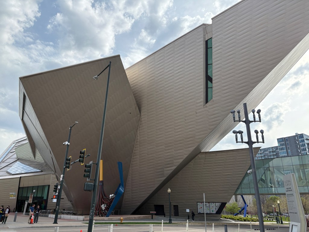
We walked around and visited the museum.
We had dinner at our condo building using the barbecue facilities.

Thursday, April 24
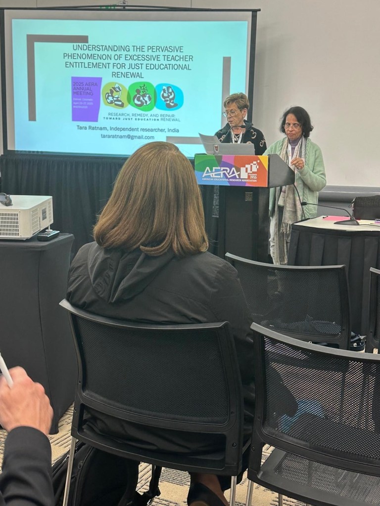
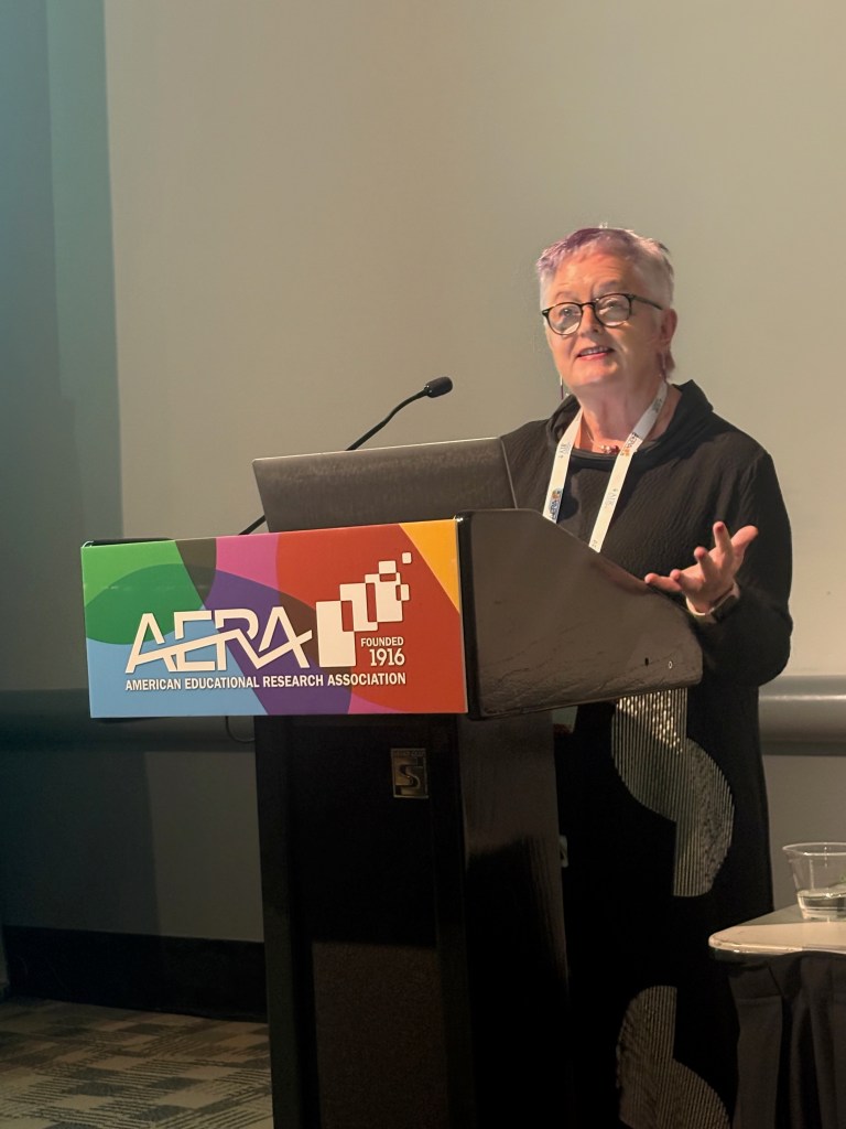
Mairin and I attended some sessions and I chaired the symposium for Tara Ratnam.
We returned to the apartment using the Lyft taxi system for dinner.
Friday, April 25
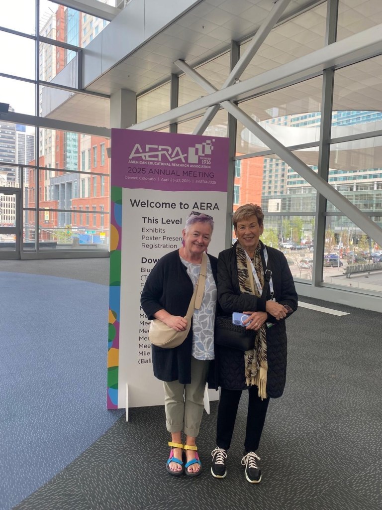
Mairin and I attended some sessions in the morning, Mairin had her session and we had our paper session at 1:25. We attended a few more in the afternoon and returned to the apartment for dinner.
Saturday, April 26
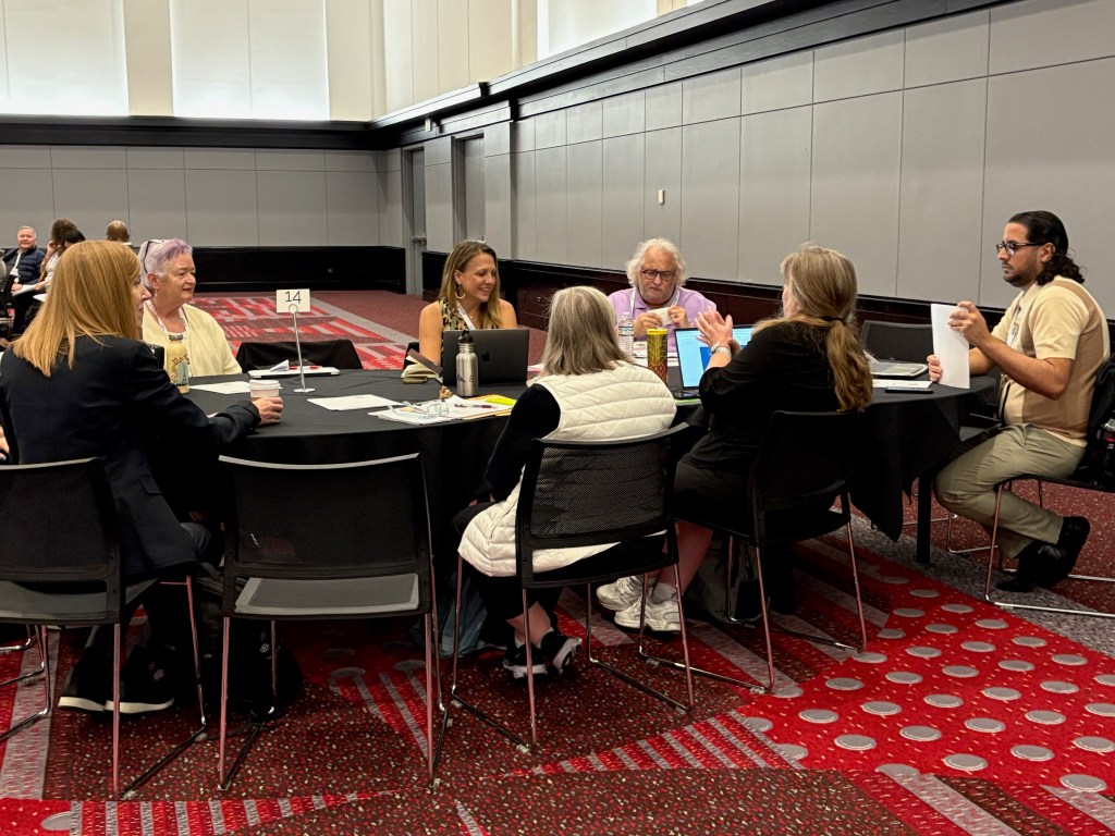
We attended a session of the Teacher as Researcher where Michelle Vaughan’s student, Erica Cheva, presented her research.

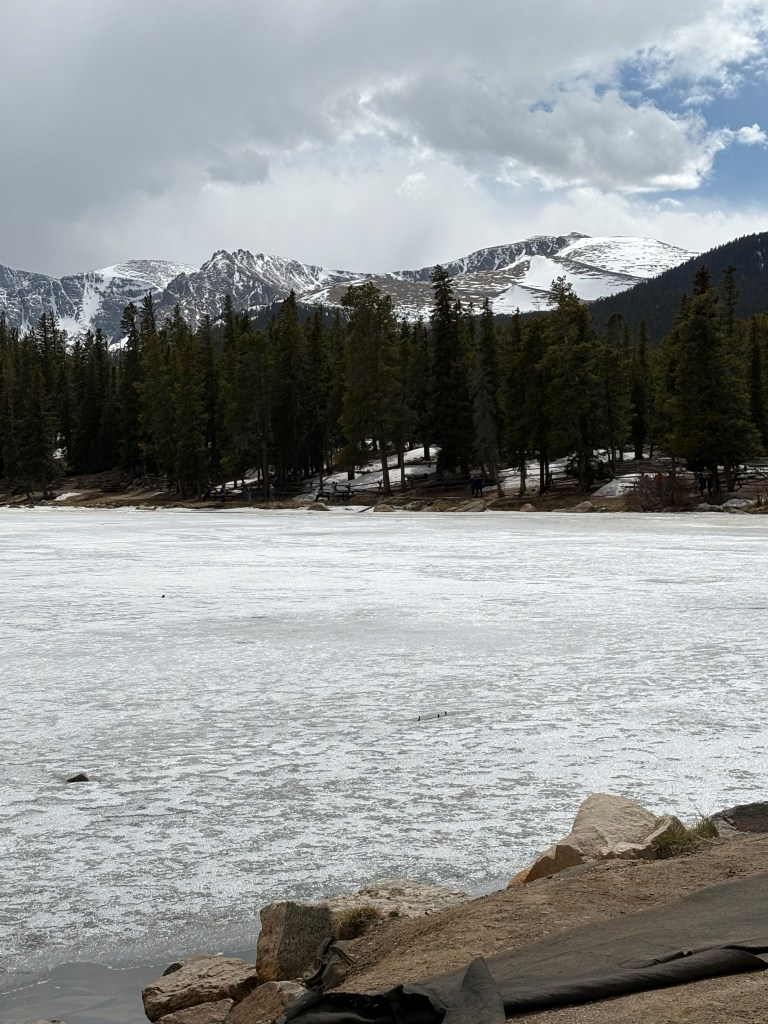
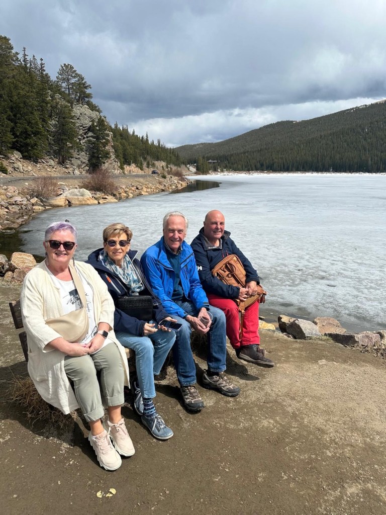
We took an afternoon tour of the Rockies.
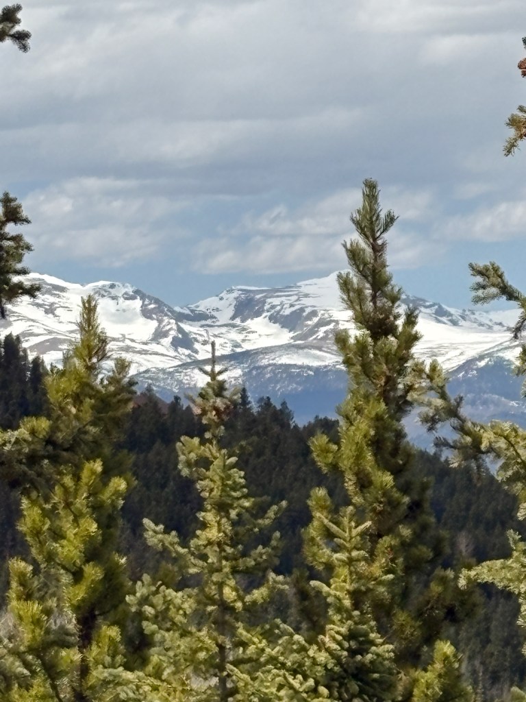
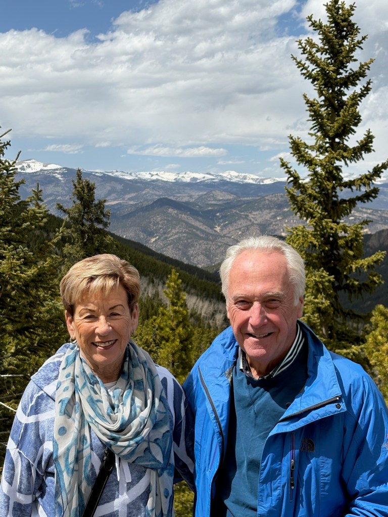
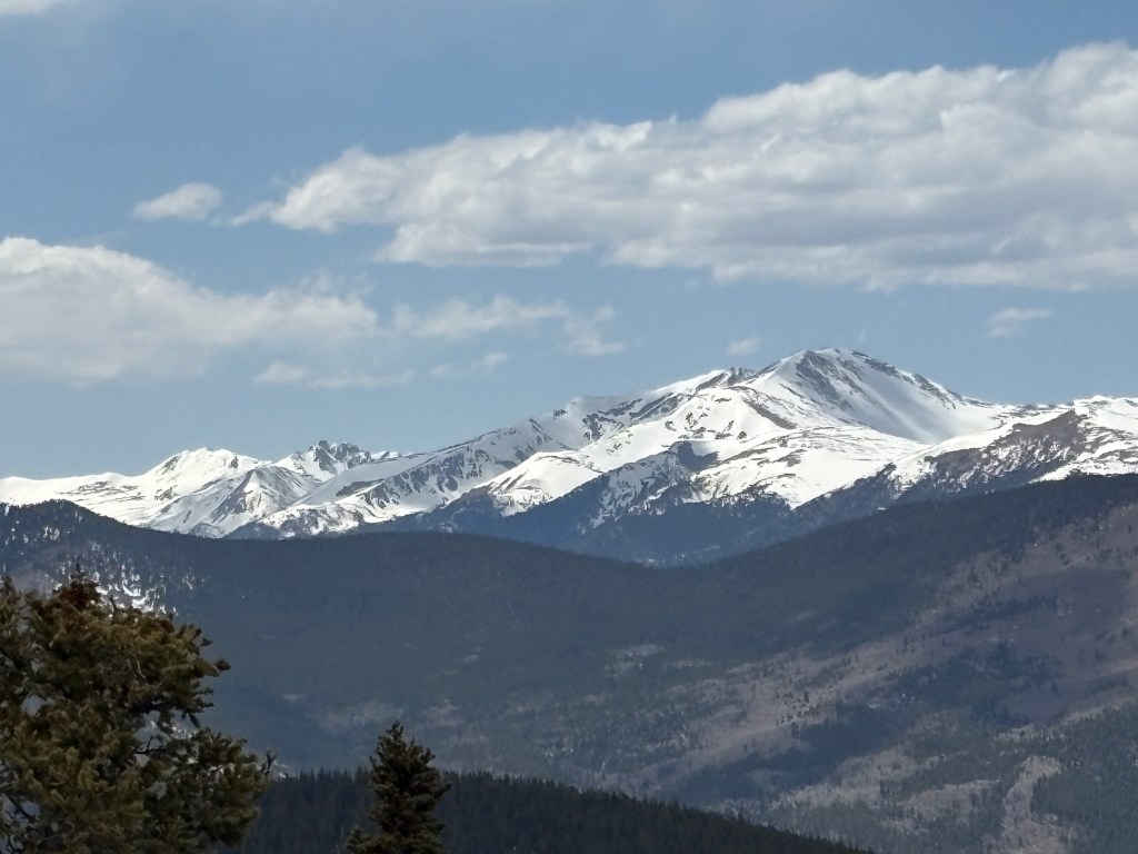
Then we went to Echo Lake.

We walked around Denver downtown. For dinner we went to Corinne’s and all had a good meal except Mairin whose pasta was less than wonderful
Sunday, April 27
We took the Lyft to Union Station but when the train was delayed, we took another Lyft to the airport. Our American Airlines flight at 8:20 was delayed because of high traffic in Phoenix and then we had to refuel so we were anxious about missing our connection to Flagstaff and then our tour the next day. It was tight but we made it because of an 2 and a half hour layover in Phoenix that became 30 minutes. We arrived early afternoon at our Americana Motor Hotel, a very inexpensive accommodation with a space theme. We walked to the Fat Olive for dinner in a cold and fierce wind where we had a delightful mostly-vegetables thin-crust pizza. We were asleep by 8:30 pm!
Monday, April 28
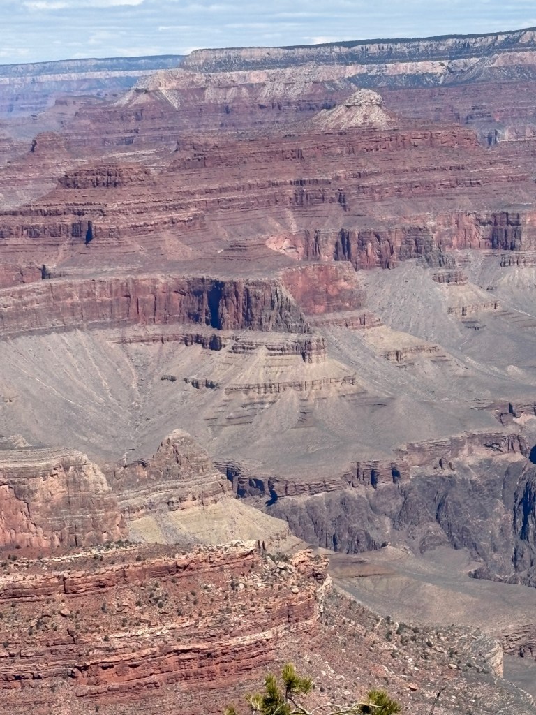
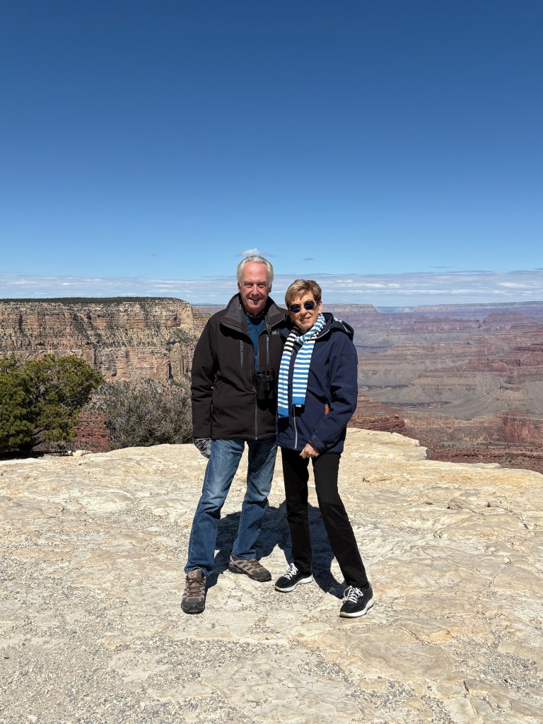
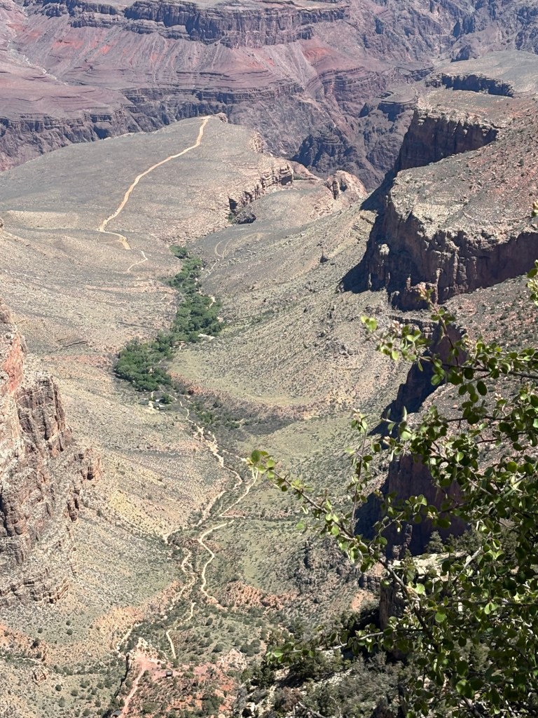
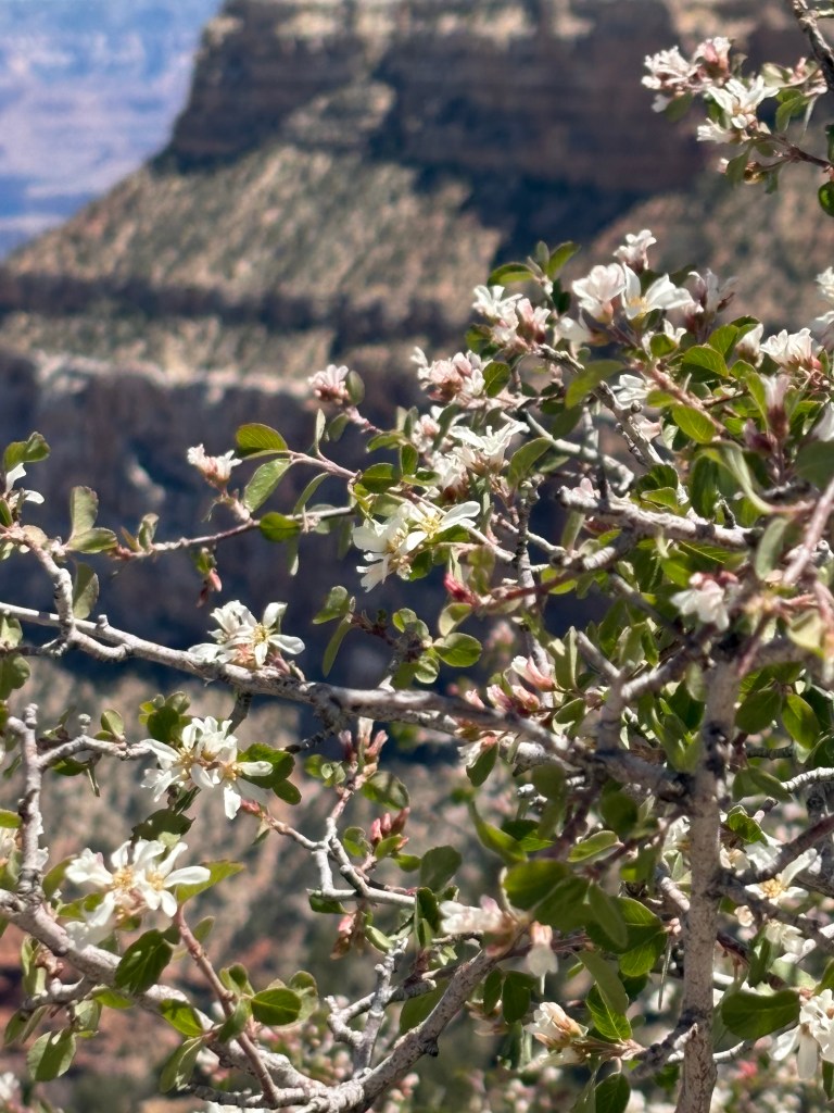
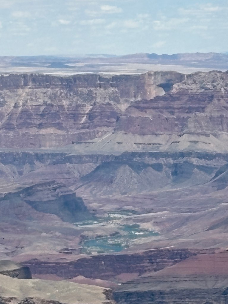
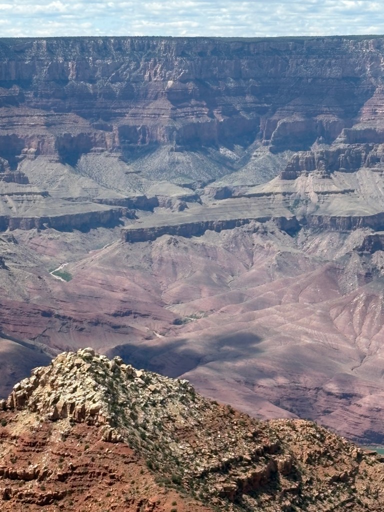
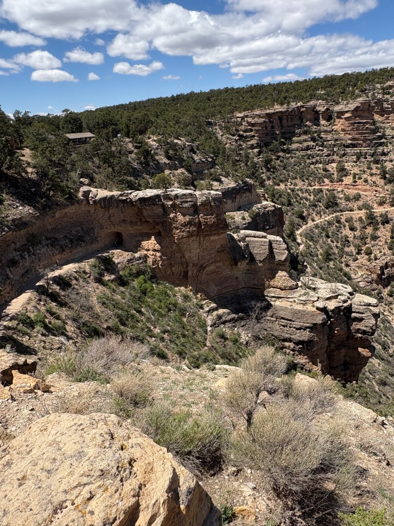
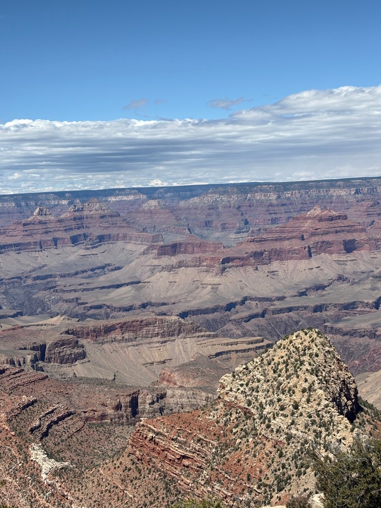
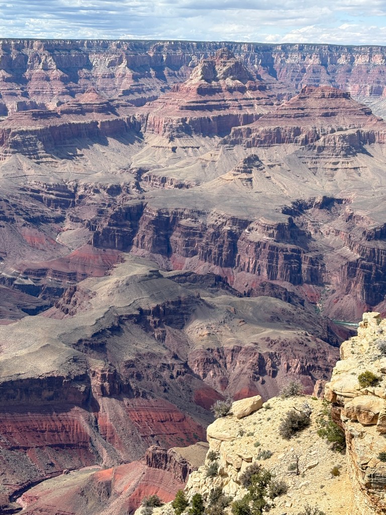
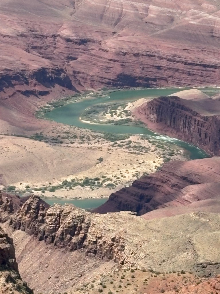
It was 0 degrees when we were picked up at 7:45 by Keaton, the guide, of Canyon Dave’s Tours; on the way we picked up a couple and their adult son in Flagstaff and another couple in Williams on the way to the Grand Canyon. Keaton shared his geological and historical knowledge of the area and of the Grand Canyon non-stop on the hour and a half trip. The first glimpse was awesome.
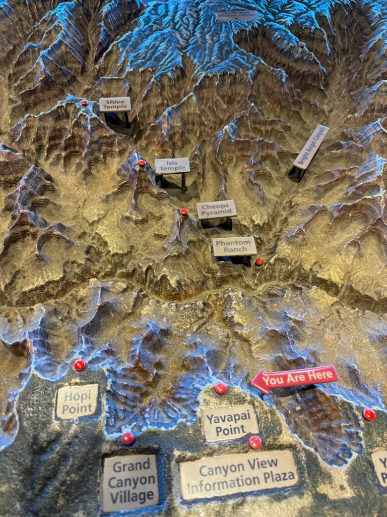
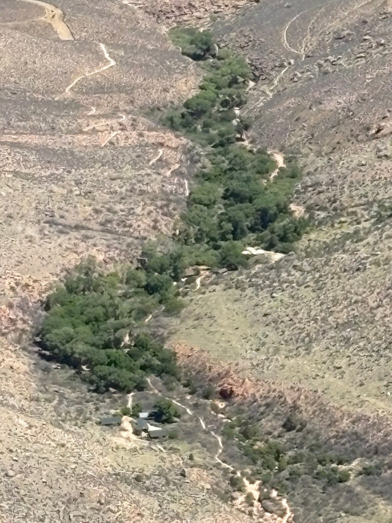
What you see from Yavapai Point Museum, and outlined here, is only a fraction of the larger Grand Canyon.
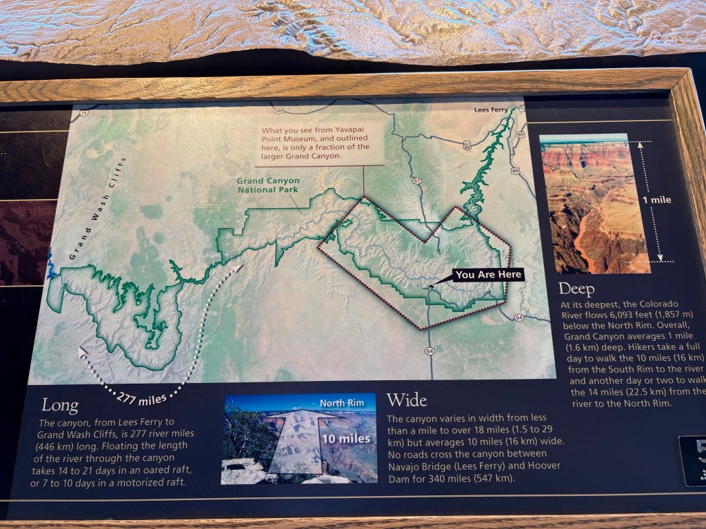
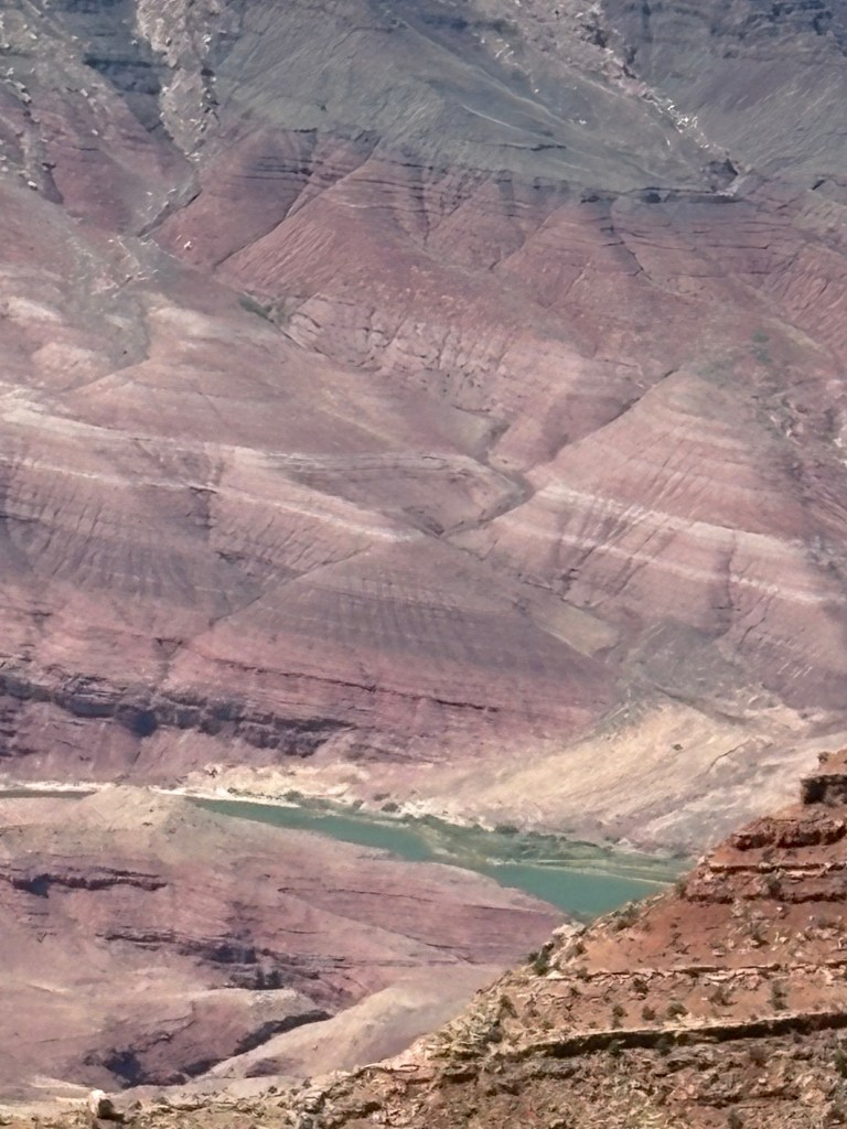
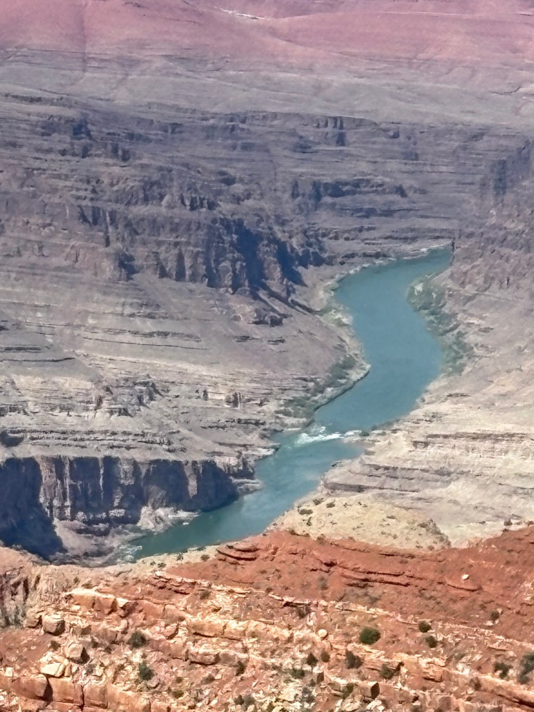
It is long. The canyon, from Lees Ferry to Grand Wash Cliffs, is 277 river miles (446 km) long. Floating the length of the river through the canyon takes 14 to 21 days in an oared raft, or 7 to 10 days in a motorized raft.
It is wide.
The canyon varies in width from less than a mile to over 18 miles (1.5 to 29 km) but averages 10 miles (16 km) wide. No roads cross the canyon between Navajo Bridge (Lees Ferry) and Hoover Dam for 340 miles (547 km).
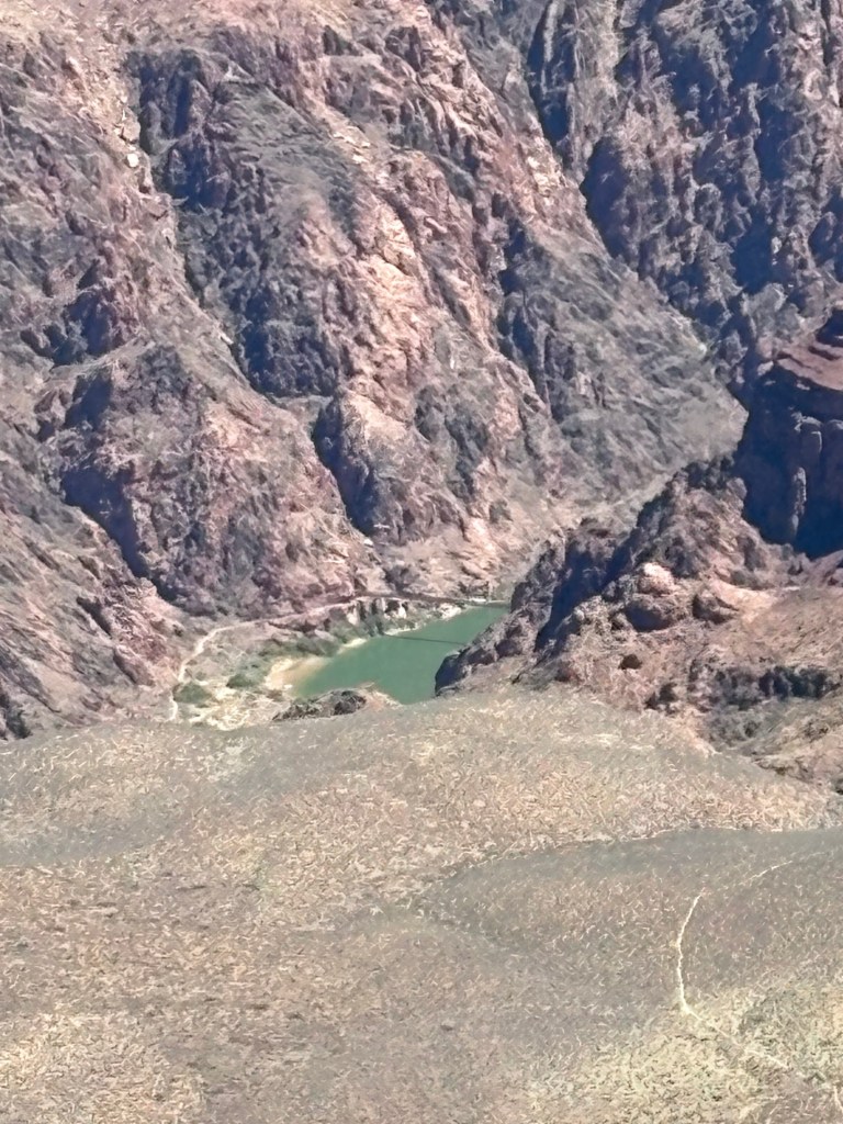
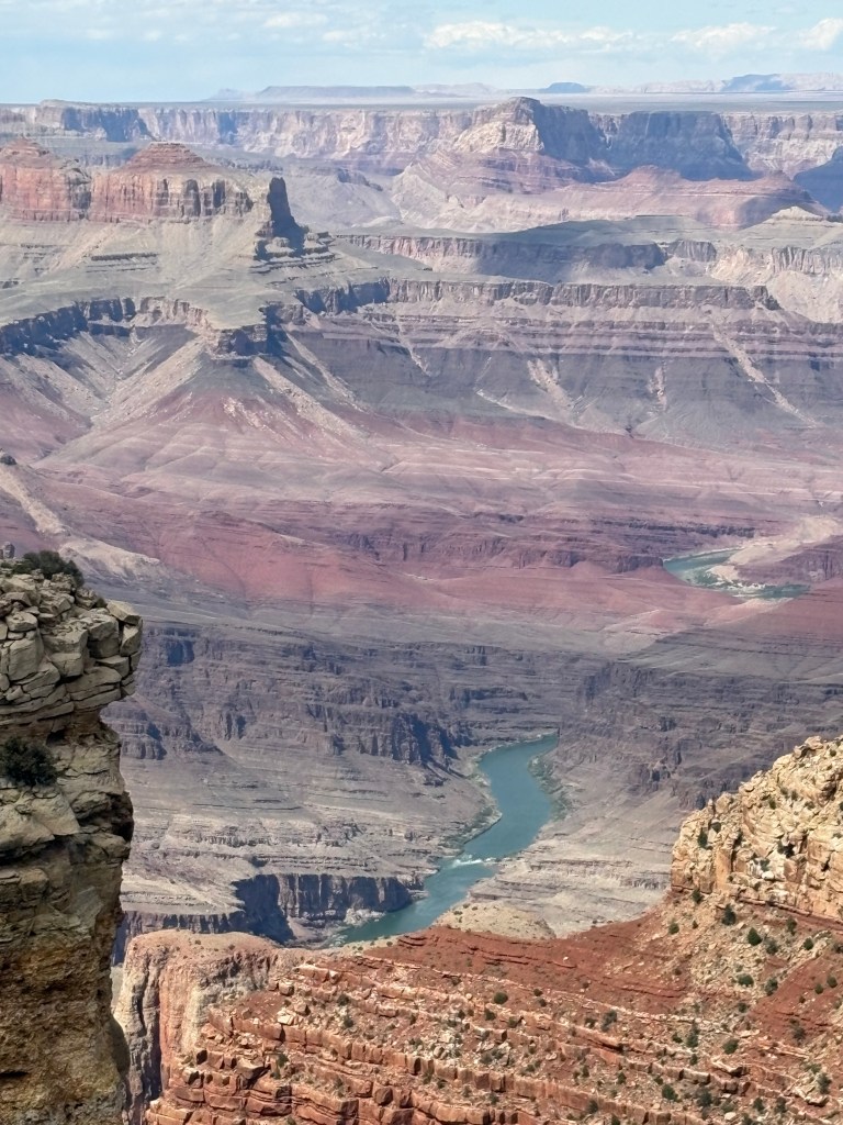
It is deep. At its deepest, the Colorado River flows 6,093 feet (1,857 m) below the North Rim. Overall, Grand Canyon averages 1 mile (1.6 km) deep. Hikers take a full day to walk the 10 miles (16 km) from the South Rim to the river and another day or two to walk the 14 miles (22.5 km) from the river to the North Rim.
The Yavapai Point Museum presents one of the grandest views on Earth. But this is not just any view of Grand Canyon. Some of the most eminent scientific minds gathered in the national park to select the best representative view of Grand Canyon geology. They chose this site and conceived of this building to showcase one of the world’s greatest wonders.
On a clear day you can easily see Mount Trumbull just above the western horizon, 62 miles (99 km) away.
Most days, haze makes spotting this distant landmark difficult. Sadly, most of this haze is human-caused. It can be a plume from a local forest fire, but usually haze is pollution from urban and industrial areas hundreds of miles to the south and west, and even from Asia.
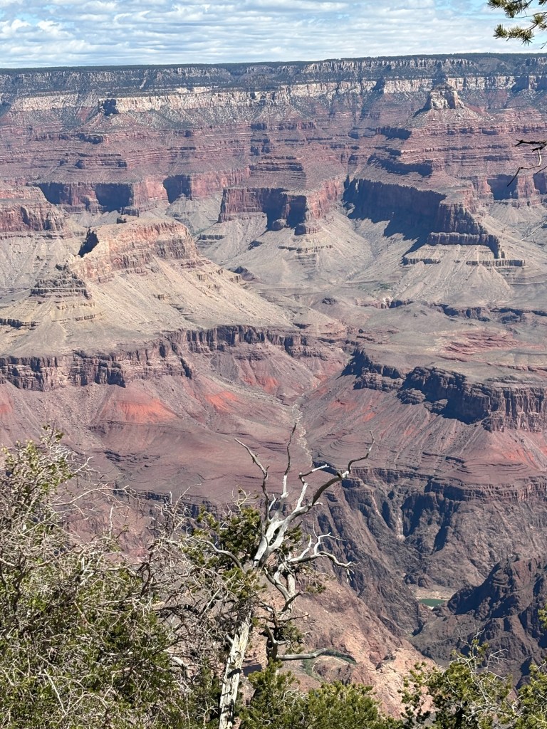
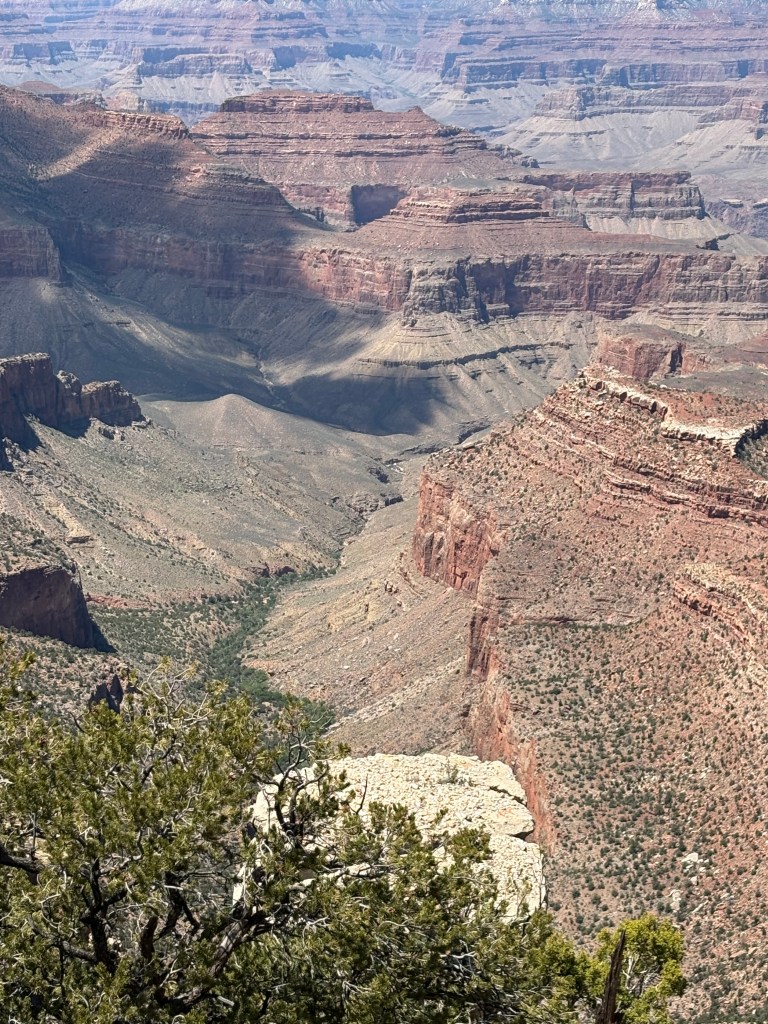
As the Colorado River cut down, the canyon rims retreated. Groundwater and springs hasten the erosion. They percolate through the rock, slowly washing away the softer rock, undermining or sapping the cliffs. Undercut, the cliffs collapse, littering the slopes below with fractured rock.
As the cliffs retreat, episodic floods flash down their slopes. Torrents of water sweep loose gravel, rocks, and boulders down the normally dry tributaries, scouring the bedrock and deepening the channels. Eventually, the tributary canyons join one another, leaving rock islands called temples.
The undermining of rock layers continues, creating taller and smaller temples, as the hard caprock falls away. Over time, the hard rock—limestones and sandstones—is whittled away, leaving only the soft rock—mudstones and shales. Unprotected, these soft rocks erode quickly to expose a lower layer of hard rock. The process continues, and the canyon grows wider and wider.
The Colorado River races 1,400 miles from its headwaters in the Rocky Mountains to its end at the Gulf of California. Twenty percent of its course (277 miles) winds through Grand Canyon.
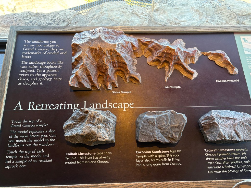
The landforms are not unique to Grand Canyon; they are trademarks of eroded arid lands. The landscape looks like vast ruins, thoughtlessly sculpted. Let a pattern exists to the apparent chaos, and geology helps us decipher it.
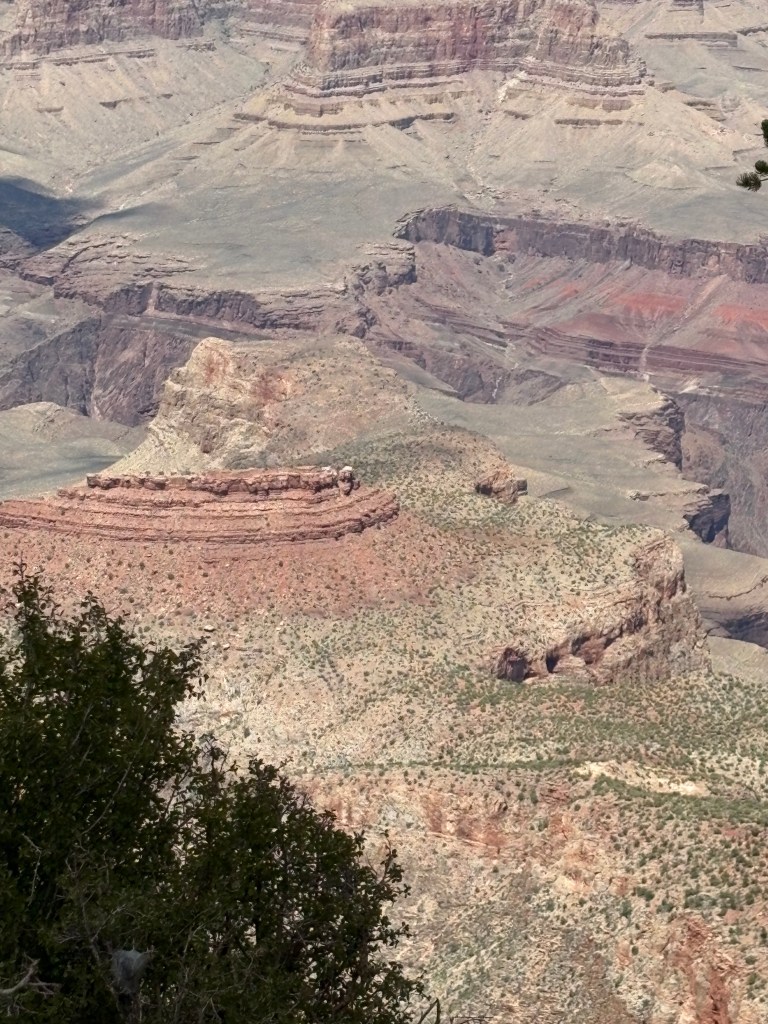
Kaibab Limestone caps Shiva Temple. This layer has already eroded from Isis and Cheops.
Coconino Sandstone tops Isis Temple with a spire. This rock layer also forms cliffs in Shiva, but is long gone from Cheops.
Redwall Limestone protects Cheops Pyramid’s crown. All three temples have this rock layer. One after another, each will wear a Redwall Limestone cap with the passage of time
KOLB BROTHERS Gallery
THE KOLB BROTHERS EMBODIED the rugged individualism and frontier spirit of pioneers in Arizona Territory. For admirers of early Arizona life and those who share the Kolbs’love of the Grand Canyon, the Kolb Collection provides a wealth of materials in all media; it represents a 74-year-span of Northern Arizona history, from pre-statehood to the latter part of the 20th century.
Housed at Northern Arizona University’s Cline Library Special Collections and Archives in Flagstaff, Arizona. The collection serves as a valuable source for Grand Canyon history, as well as a fascinating window to the history of photographic technology in the 20th century. More than 10,000 images from the Kolb Collection and the “Grand Canyon Film Show” are now accessible online via the Colorado Plateau Archives at Cline Library Special Collections and Archives
http://archive.library.nau.edu/index.php.
THE KOLB BROTHERS began exploring their new home immediately upon arrival. Hauling bulky camera equipment and heavy glass plates, they found their way to remote side canyons to photograph parts of the Grand Canyon that few people, if any, had seen.
Though they were largely unacquainted with boating, they could not resist the Colorado River’s powerful draw. Within a few years they had acquired enough experience to establish their reputation as capable river guides. By
1917 Ellsworth had also run and photographed the Colorado’s major tributaries-the Green, Grand, and Gunnison Rivers.
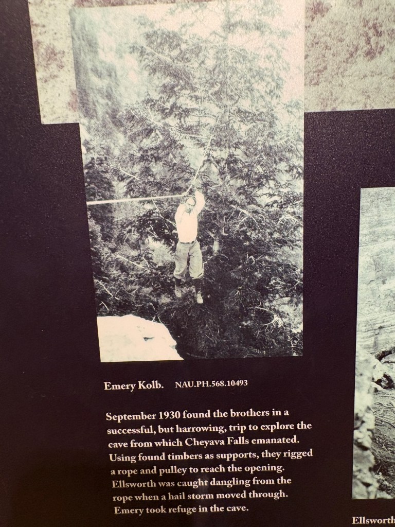
September 1930 found the brothers in a successful, but harrowing, trip to explore the cave from which Cheyava Falls emanated. Using found timbers as supports, they rigged a rope and pulley to reach the opening. Ellsworth was caught dangling from the rope when a hail storm moved through. Emery took refuge in the cave.
Three Sets of Rock
Grand Canyon exposes a beautiful, almost bewildering, panorama of rock. But its many rock layers are easily grouped into three sets, with the youngest on top and the oldest on the bottom.
Paleozoic Rocks-Sedimentary rocks a retain their original horizontal layering
Supergroup Rocks-Tilted remnants of. sedimentary and igneous rocks, sporadically exposed beneath the Paleozoic layers.
Basement Rocks
Contorted folds of metamorphic rocks and igneous intrusions in the depths of the canyon reflect their tortured past.

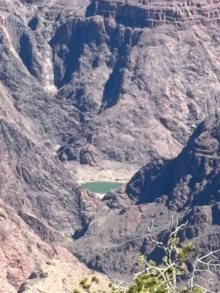
The Colorado River, like liquid sandpaper, uses the sediments it carries to carve its canyons. Driven by weather and climate, the Colorado deepens its course. The river gathers rain and snowmelt from the Rocky Mountains. Swollen by springtime runoff and summer storms, the Colorado’s muddy waters churn. Silt, sand, and cobbles grind against each other and against bedrock channels. Its water carries the abrasive load downstream, ultimately surrendering it to the Gulf of California. Empowered by time over 5 million years worth-the river does what gravity demands
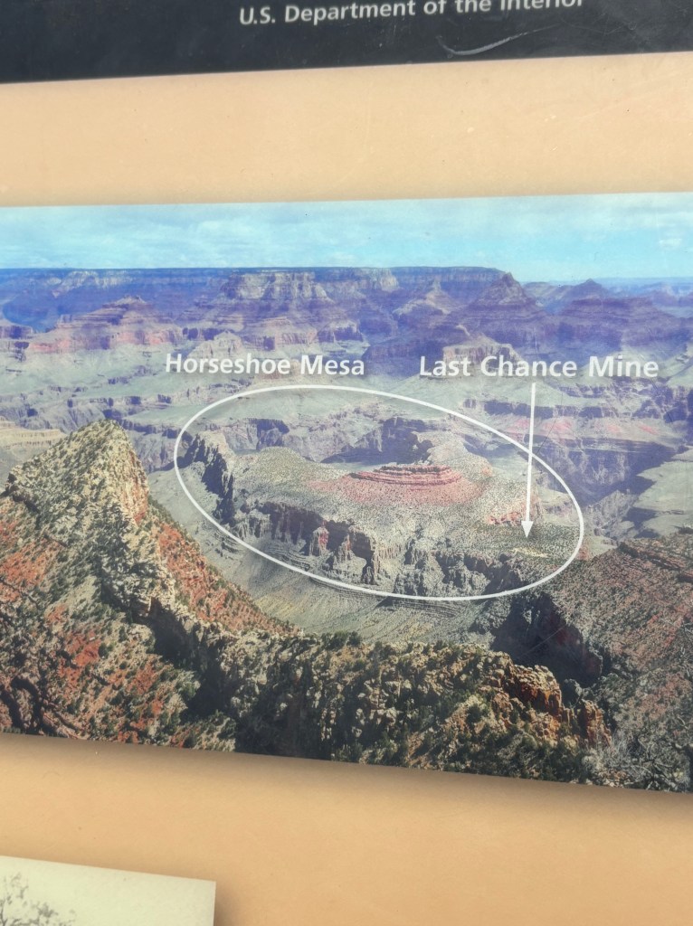
In 1890 prospector Pete Berry staked the Last Chance copper claim on Horseshoe Mesa. The Last Chance Mine began a 17-year flurry of activity at Grandview Point.
For a while the Last Chance Mine thrived. The ore was rich; it claimed a World’s Fair prize in Chicago in 1893 for being over 70% pure copper. But the high cost of packing ore to the rim, then shipping it to be refined, doomed the operation. Berry and his partners sold the mine in 1901.
The new owners continued mining, but ceased when copper prices plunged in 1907.
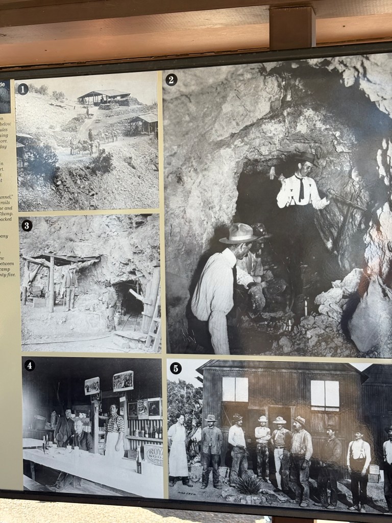
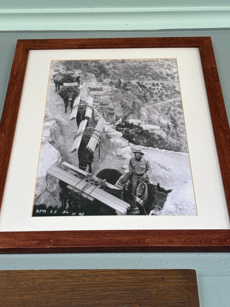
- The Last Chance Mine on Horseshoe Mesa, 1/2 mile below the canyon rim, 1890s. Mules and burros packed everything in and packed out tons of ore.
Miners earned $4.00 per day plus meals. - Inspectors sample ore in 1907 for a company report.
The results were good, but copper prices crashed that year, dooming the mine. - Entrance to the “new tunnel,”
- The narrow gauge rails brought ore from the mine and carried waste rock to the dump. The large timbers were packed in from the rim.
- Canyon Copper Company dining room, 1906.
- The crew poses for the company report. The crew averaged just five men between 1902 and 1907, but the camp could accommodate twenty-five.
Mining on Horseshoe Mesa, though short-lived, had a lasting impact.
Grandview became Grand Canyon’s most popular tourist area for about 10 years when Grand Canyon tourism was in its infancy. The Grandview Trail, built by Last Chance miners to reach their mines, now serves thousands of hikers each year.
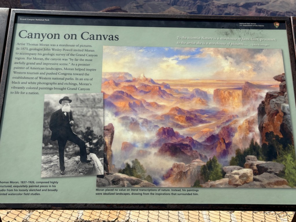
Artist Thomas Moran was a storehouse of pictures. In 1873, geologist John Wesley Powell invited Moran to accompany his geologic survey of the Grand Canyon region. For Moran, the canyon was “by far the most awfully grand and impressive scene.” As a premier painter of American landscapes, Moran helped inspire Western tourism and pushed Congress toward the establishment of Western national parks. In an era of black and white photographs and etchings, Moran’s vibrantly-coloured paintings brought Grand Canyon to life.
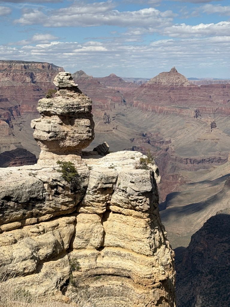
Grand Canyon’s seemingly endless formations evoke shapes that only our imaginations can bring to life. Early mapmakers saw castles and temples in the rocks. Taking a playful look at Grand Canyon-like imagining the shape of a duck in the rock that stands before you. Decade after decade, visitors come to this spot to look for the “Duck on a Rock.” Nothing in Grand Canyon is static. One day, the duck-like shape will take a different form as the power of erosion slowly sculpts it: in 50 or 100 years, the duck will be transformed.
Tuesday, April 29 Denver
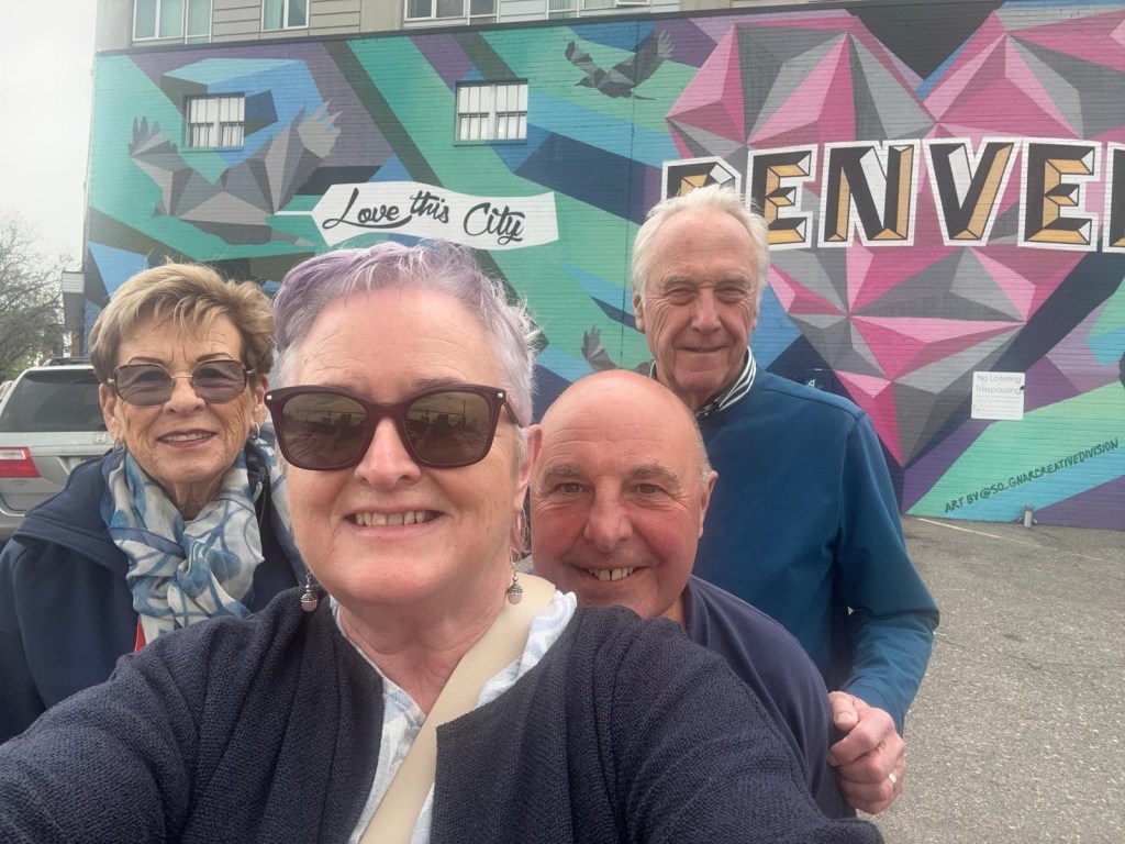
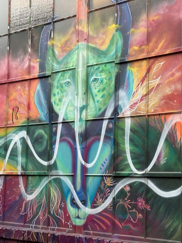
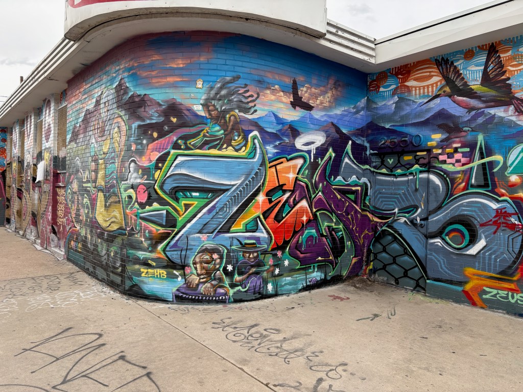
We walked around the street art in downtown Denver.

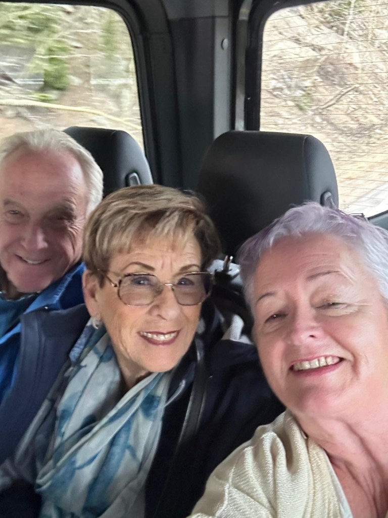
We had a great time together with Mairin and Red.